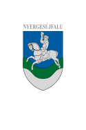
Nyergesújfalu
Aspet
| Quest articol chì l'è scrivud in lombard, con la Noeuva Ortografia Lombarda |
| Nyergesújfalu Comun | |||||
|---|---|---|---|---|---|
| |||||
 | |||||
| Dats aministrativ | |||||
| Stat | |||||
| Contea | Komárom-Esztergom | ||||
| Distret | Distret de Esztergom | ||||
| Politega | |||||
| Sindegh | |||||
| Territore | |||||
| Coordinade | 47°45′37″N 18°33′24″E / 47.760278°N 18.556667°E | ||||
| OSM | 1027805 | ||||
| Superfix | 39,51 km² | ||||
| Abitants | 7 227 ab. (1º genar 2024) | ||||
| Densitaa | 182.92 ab./km² | ||||
| Confin | Tát, Mogyorósbánya, Bajót, Nagysáp, Bajna (Ongaria), Héreg, Süttő, Lábatlan, Mužla e Obid | ||||
| Fus orari | Central European Time | ||||
| Varie | |||||
| Prefiss | 33 | ||||
| Codex postal | 2536 | ||||
| Localizazion | |||||
| Sit istituzional | |||||
Nyergesújfalu a l'è un comun del Distret de Esztergom, cont una popolazzion de 7227 abitant.
Riferiment
[Modifega | modifica 'l sorgent]Alter proget
[Modifega | modifica 'l sorgent] Wikimedia Commons el gh'ha dent imagin o alter archivi su Nyergesújfalu


