
Archivi:Africa-countries-eastern.png
Nissuna resoluzzion maggiora disponibil.
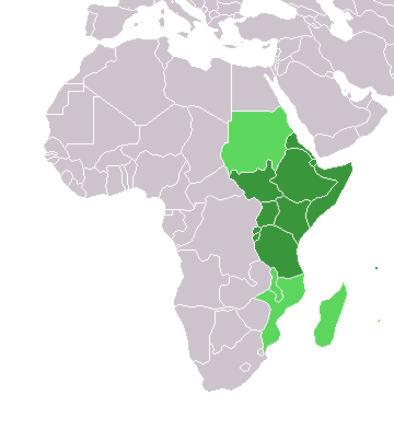
Africa-countries-eastern.png (360 × 392 picsel, dimension : 10 KByte, sort MIME: image/png)

|
Ghe xe na version vetoriale de sta imagine ("SVG").
Te pol dopararla al posto de sta imagine raster co che xe necessaria na risolussion superiore. File:Africa-countries-eastern.png → File:Africa-countries-eastern.svg
Par savérghene piassè su la grafica vetoriale lèzi: Commons:conversion a SVG. Ghe xe anca informassion de suporto a le imagini SVG in MediaWiki. |
 |
from en:Image:Africa-countries-eastern.png
This map was originally made by w:en:User:Joy on 01:28, 28 March 2004 who created it from the blank maps.

|
A l'è permess de copià, spantega e/o portagh di cambiament a quell document chì conforma ai termin de la GNU Free Documentation License, Version 1.2 o i so version vegnud adrée missa foeura de la Free Software Foundation; con tucce i sezzion che poden vesser soggette a di cambiament, senza de test de covertina e senza de test de retrocovertina . Una copia de la licenza è dent in la sezion che 'l so titol a l'èTest de la GNU Free Documentation License. |
| Quell fail chì l'è concedud in licenza sota la licenza Creative Commons Attribution-Share Alike 3.0 Unported | ||
Te gh'hee de fornì i sgiust credit, un conligament a la licenza e insegnà semai che ghe sien stad portad di cambiament. Te podet fall in una quaisevoeur manera rasgionevol, ma minga d'ona manera che la sugerissa che l'autor approva ti o la toa utilizazzion.
| ||
| Quest'eticheta chì, sora 'ldirit d'autor, l'è stada sgiontada a quell fail chì come part de l'atualizazzion de la licenza di proget Wikimedia. |
Cronologia de l'archivi
Schiscia in su un grup data/ora per vedè l'archivi com 'a l'è che l'era in quell moment là
| Data/Ora | Miniadura | Grandezza | Utent | Coment | |
|---|---|---|---|---|---|
| corent | 21:08, 17 Mrz 2018 | | 360 × 392 (10 KByte) | Maphobbyist | Upload |
| 19:42, 13 gen 2014 |  | 360 × 392 (10 KByte) | VVVF | See http://unstats.un.org/unsd/methods/m49/m49regin.htm | |
| 18:18, 13 gen 2014 |  | 360 × 392 (10 KByte) | VVVF | See http://unstats.un.org/unsd/methods/m49/m49regin.htm | |
| 19:06, 9 Lui 2011 |  | 360 × 392 (13 KByte) | Maphobbyist | South Sudan has become independent on July 9, 2011. Sudan and South Sudan are shown with the new international border between them. | |
| 23:34, 31 Mrz 2011 |  | 360 × 392 (13 KByte) | Hoshie | added Cabinda (Angola) and Montenengro to the map. | |
| 13:12, 5 masg 2006 |  | 360 × 392 (4 KByte) | Hautala | optimized with png | |
| 20:28, 29 avr 2005 |  | 360 × 392 (13 KByte) | ChongDae | from en:Image:Africa-countries-eastern.png {{GFDL}} Category:Map of Africa |
Ligámm
A gh'è minga de pagine che doperen quell fail chì.
Utilizazzion global di fail
Anca questi Wiki chì a dopren quell fail chì:
- Doperad in af.wikipedia.org
- Doperad in ar.wikipedia.org
- Doperad in azb.wikipedia.org
- Doperad in az.wikipedia.org
- Doperad in bg.wikipedia.org
- Doperad in bm.wikipedia.org
- Doperad in br.wikipedia.org
- Doperad in cs.wikipedia.org
- Doperad in cv.wikipedia.org
- Doperad in en.wikipedia.org
- Doperad in es.wikipedia.org
- Doperad in eu.wikipedia.org
- Doperad in fr.wikipedia.org
- Doperad in he.wikipedia.org
- Doperad in hy.wikipedia.org
- Doperad in id.wikipedia.org
- Doperad in incubator.wikimedia.org
- Doperad in is.wikipedia.org
- Doperad in it.wikipedia.org
- Doperad in jv.wikipedia.org
- Doperad in kaa.wikipedia.org
- Doperad in kbd.wikipedia.org
Varda utilizazzion global de quell fail chì.